Getting Off The Beaten Path
By David Burke / Images by Joern Rohde
Millions of people come to Whistler each year to get away from it all — to find more space, breathe the fresh mountain air and enjoy all that the resort and the Coast Mountains have to offer. The creature comforts available here, including terrific spas, fantastic restaurants and the ambiance of Whistler Village, are among the many reasons Whistler consistently ranks as North America’s No. 1 four-season resort.
Sometimes, though, it takes a plan and a bit of insider knowledge to find that space — to go for a hike, find an under-appreciated waterfall or swimming hole, and to spend a day among the splendour of the mountains. So, here are some easily accessible outdoor locations and experiences in and around the resort. Plus, we offer a few “locals’ tips” on getting outdoors, away from the crowds, and enjoying some of the nearby unique places that both locals and visitors can enjoy.
A few of the places mentioned below can be busy, and it takes a bit of planning — visiting midweek to avoid the weekend crowds, for example — to truly space yourselves out. But, if you can’t avoid the busier times, we also offer nearby alternatives that are a bit more off the beaten path.
South of the Village
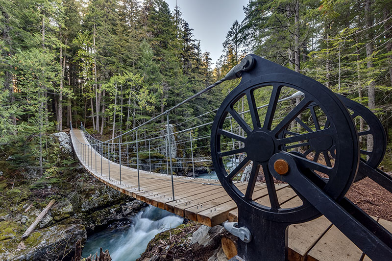
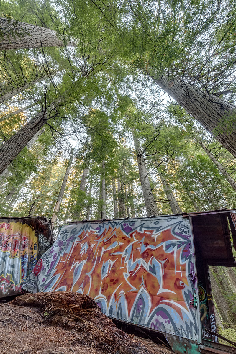
Cheakamus Crossing, opposite Function Junction on the east side of Highway 99, is home to the Whistler Interpretive Forest, an area that includes several excellent, moderate-distance hikes, as well as the trailhead for the popular Train Wreck Trail. The latter incorporates a suspension bridge that crosses the roaring Cheakamus River, and on the other side, there’s an old train wreck that’s renowned for its colourful and unique graffiti. The out-and-back trail is 5 kilometres long and rated as easy.
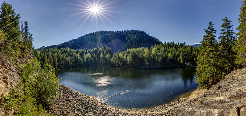
The Farside/Riverside Trail loop and Crater Rim Trail are also popular. The most accessible starting point for this trail is a parking area just off Highway 99. Hikers trek upriver along either side to the MacLaurin’s Crossing Suspension Bridge and back on the other side. From parking areas along West Side Main Road, you can access the Crater Rim Trail, rated as moderate to difficult. It includes a circuit of Logger’s Lake, a serene water body that fills an old volcanic crater and is ideal for swimming.
whistler.ca/culture-recreation/trails
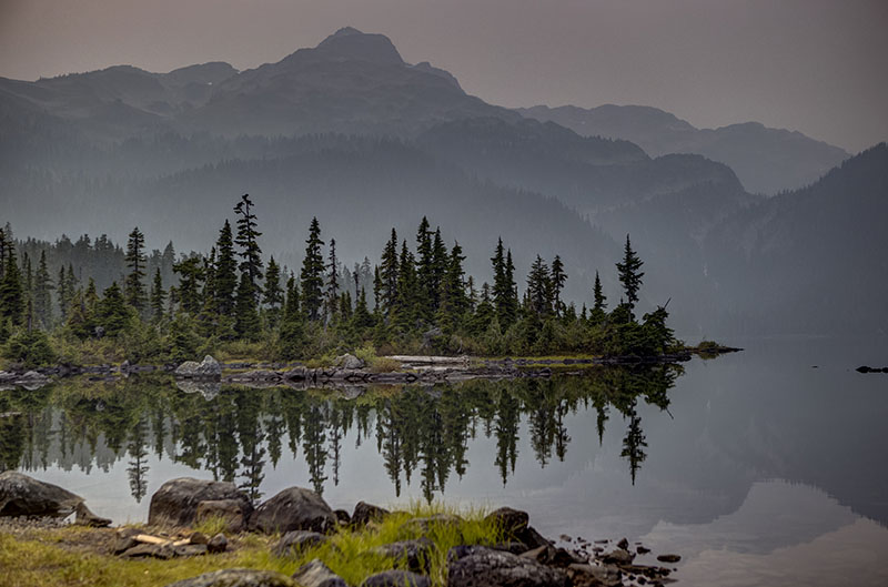
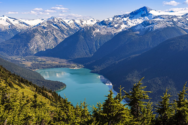
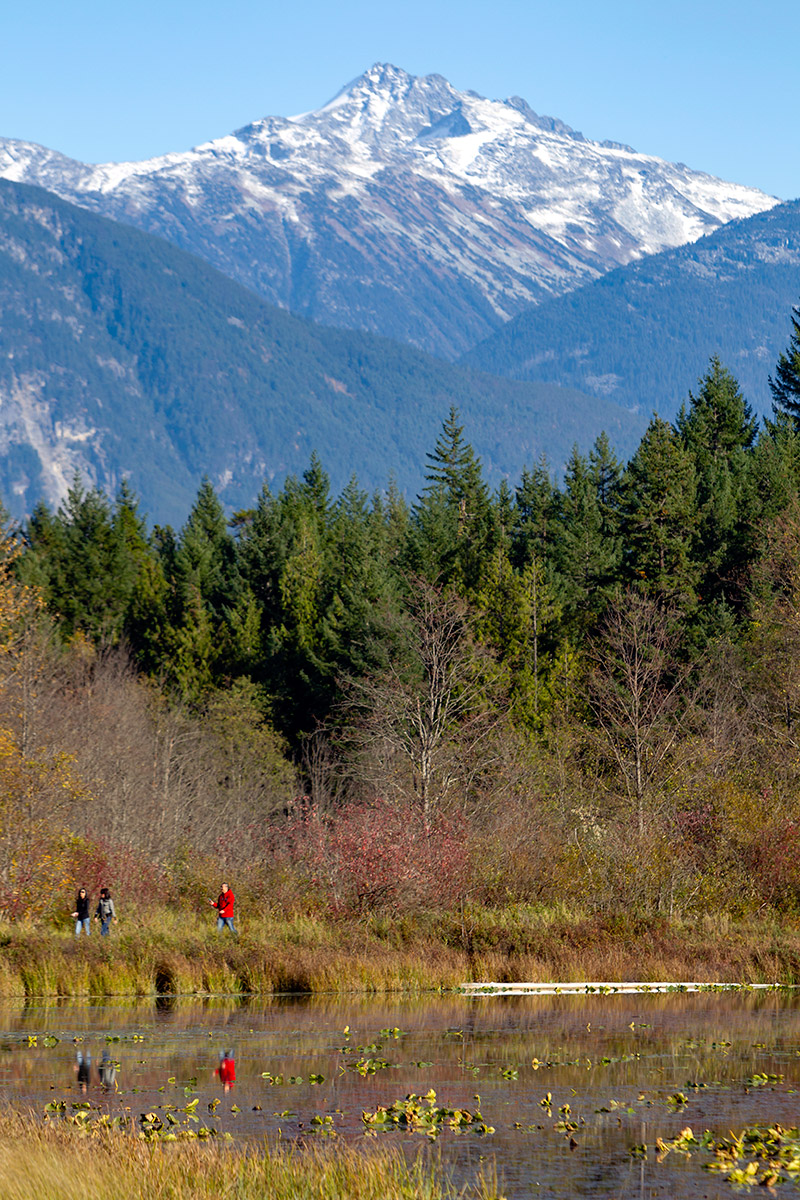
You can also follow the 7 km gravel East Side Main Road to the trailhead for the Cheakamus Lake hike. You’ll reach the lake’s north end after just 3 km, but if you carry on along the lakeshore, you can enjoy views of its turquoise waters; it’s 14 km round trip and rated as easy. The lake is in Garibaldi Provincial Park, check bcparks.ca for up-to-date information.
The Callaghan Valley, about 10 km south of Function Junction, includes a couple of semi-hidden gems: Alexander Falls and Whistler Olympic Park.
Travelling south on Highway 99, turn right up the Callaghan Valley Road. Eight kilometres up the road is the turnoff for Alexander Falls, a lovely, 43-metre (141-foot) impressive cascade on Callaghan Creek. It’s a great place to stop for a picnic and is seldom busy.
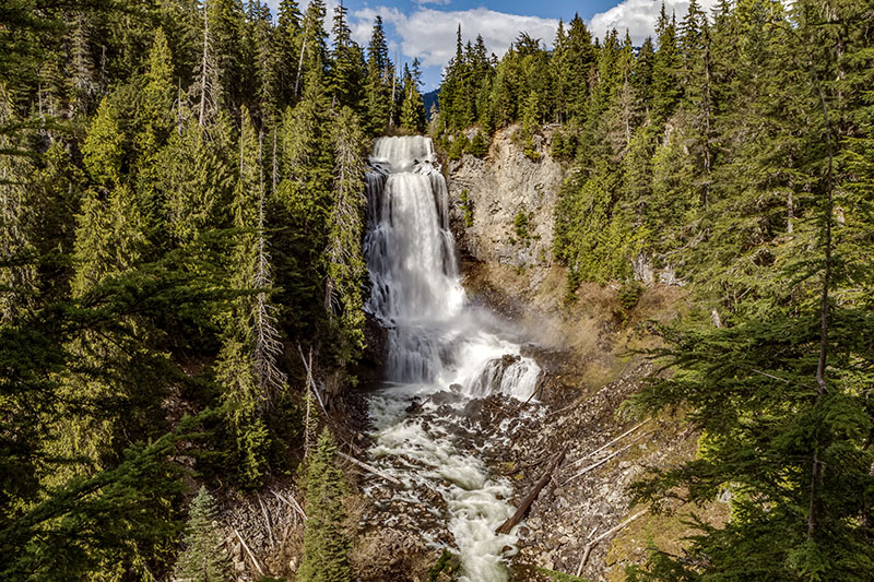
Brandywine Falls Provincial Park is another fantastic place for a picnic and is where you will find Brandywine Falls, a spectacular 70-metre (230-foot) single-drop falls. It’s an easy 10-minute walk to the falls and can be busy, especially on weekends. As an alternative, you can hike from the park to the Whistler Bungee Bridge. The hike or bike ride is 2.7 km each way on the nicely gravelled Sea to Sky Trail but includes a couple of steeper switchback sections. You can walk or bike across the bridge, with access controlled by Whistler Bungee staff. You might even get to see bungee jumpers launch themselves toward the raging Cheakamus River, 50 metres (160 feet) below. bcparks.ca
North of the Village
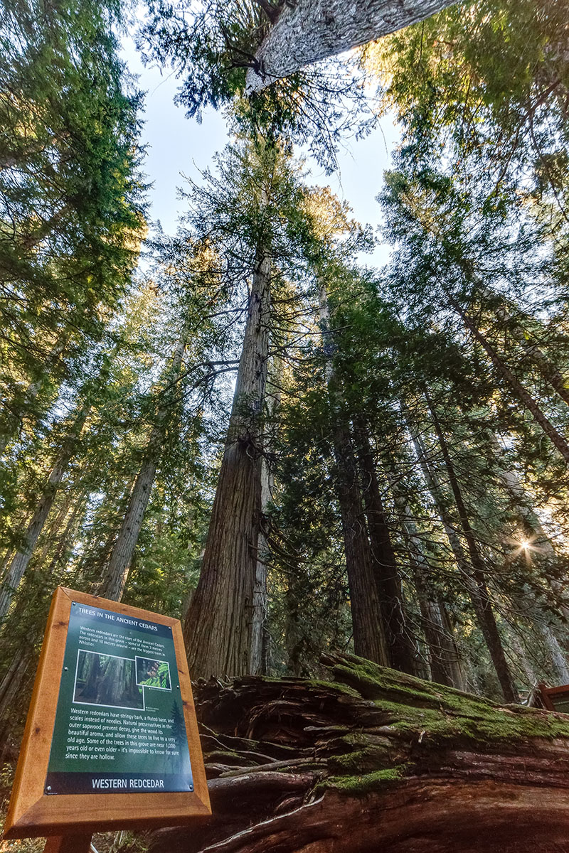
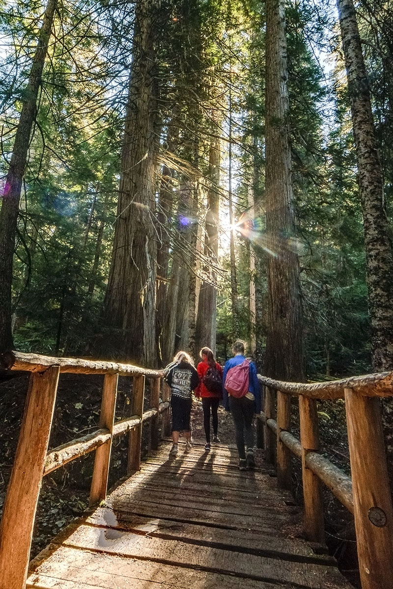
The Ancient Cedars hike is a popular route for families. From Highway 99 northbound, turn left at the Cougar Mountain Road at the north end of Green Lake. It’s a 10-minute drive up the road to a trailhead parking area. The main Ancient Cedars loop trail is a 5.1 km round-trip hike, rated easy to moderate. The main loop takes visitors uphill to an awe-inspiring grove of western red cedar trees, some up to 12 metres around, and believed to be approximately 1,000 years old. If you have more time, side trails branch off the main loop, leading hikers to the Showh Lakes and Newt Lake.
hikeinwhistler.com
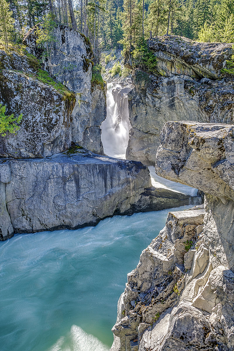
Nairn Falls Provincial Park and One Mile Lake are 20 km north on Highway 99, just south of the town of Pemberton. You can hike the relatively easy, 1.2 km (.8 mile) out-and-back trail to Nairn Falls, a 40-metre (130-foot) waterfall on Green River.
Just north of that is One Mile Lake, the favourite swimmin’ hole for Pemberton and its 3,000 residents. The small beach can be busy on hot summer days, so it may be best to avoid the weekend. And you can take a stroll around the lake, partly on boardwalks that follow the shoreline and wind through the reeds at the north end. Several other hiking/biking trails fan out from the lake, including a portion of the Sea to Sky Trail that connects with Nairn Falls Provincial Park. bcparks.ca
If you take the drive north, be sure to visit Pemberton, a laid-back farming community if ever there was one. Just east of the town on Highway 99, you can visit North Arm Farm for U-pick berries, veggies, and a café. Or venture north of the village, up the Pemberton Meadows Road for tranquil rural scenery with the towering, 2,591-metre (8,501-foot) Mount Currie as a backdrop. tourismpembertonbc.com
Enjoy!